
NWS US Graphical Forecast Maps
|
|||||||||||
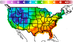
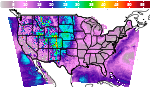
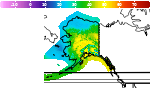
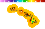
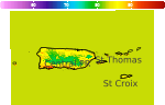
Click on a map or link to open new tab displaying area of interest.
Maps and Data Courtesy of NOAA NWS
Navigation
Alerts
Mobile Weather
Get SE LincolnWx SmartPhone Weather
 Scan With Phone's Bar Code Reader
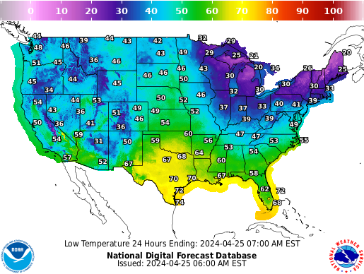
US Weather Extremes
| ========== |
| USA |
| High Temp |
| 115°F at Miles City Airport, MT 115°F at Glendive Dawson Community Airport, MT |
| Low Temp |
| 34°F at Angel Fire Airport, NM |
| Precipitation |
| 10.29in at Hampton Roads Executive Airport, VA |
| ========== |
NE Weather Extremes
| ========== |
| NE |
| for
Sunday, July 12, 2026 |
| High Temp |
| 103°F at Chadron Municipal Ap, NE |
| Low Temp |
| 59°F at Broken Bow Municipal Ap, NE |
| Precipitation |
| none |
| ========== |
| Data from NWS CPC |
External Links
Local Sunlight Hours
| (Noon) |

|
| (Midnight) |
Style Options
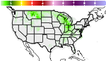
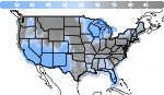
|
|||||||||||
Click on a map or link to open new tab displaying area of interest.
Maps and Data Courtesy of NOAA NWS

 
|